Old Redding Nature Reserve contains a remarkable variety of habitats for what is a relatively small site, less than half the size of Bentley Priory Nature Reserve to its east. The nature trail will take you through mature woodland, past old Victorian gardens full of exotic trees, round old lakes and newly created ponds, and into a Victorian orchard that is home to rare fruit varieties and rare insects.

There are two sections to the nature trail: The first section, indicated by the orange arrows on posts, is short and has gentle gradients so is ideal for those with limited mobility. For a longer walk that shows you the northeastern part of the site continue on the route indicated by the purple arrows. The paths here have steeper slopes and generally less even terrain.

You will see signs for two other marked routes as you walk around. The London LOOP is a 150 mile path encircling London while the Bentley Priory Circular Walk is a 4.3 mile circular walk centred on Bentley Priory Nature Reserve but which also passes through Old Redding Nature Reserve, Stanmore Common and Stanmore Little Common. A leaflet about the circular walk can be downloaded here.
If you are starting from the Old Redding viewpoint car park, take a moment to look at the dramatic views across west London including Harrow-on-the-Hill with St Mary’s Church. On a clear day the North Downs and Surrey Hills are visible on the horizon. Then leave the car park by the western, “In” entrance and carefully cross the road. Post 1 is just inside the woodland.
If you are by Gilbert’s Lake then you’ll want to start at post 4.
If you have come by bus and have got off at the ‘Sandringham’ stop then you will probably want to start at post 15.
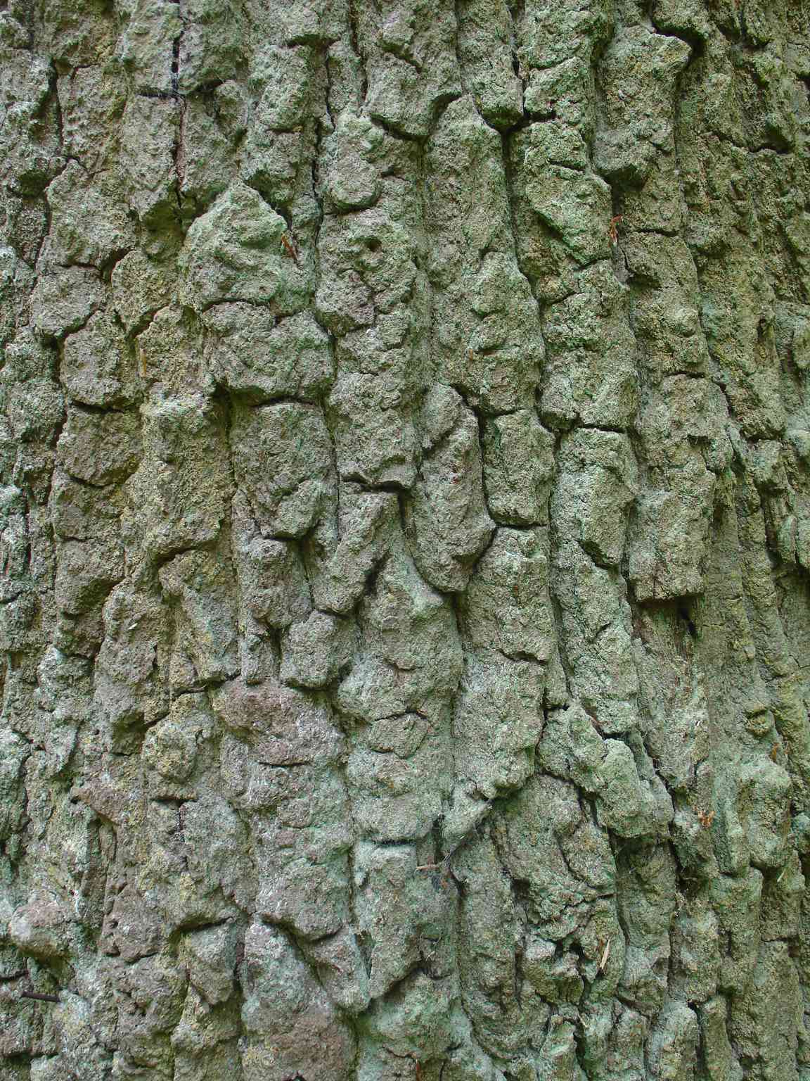
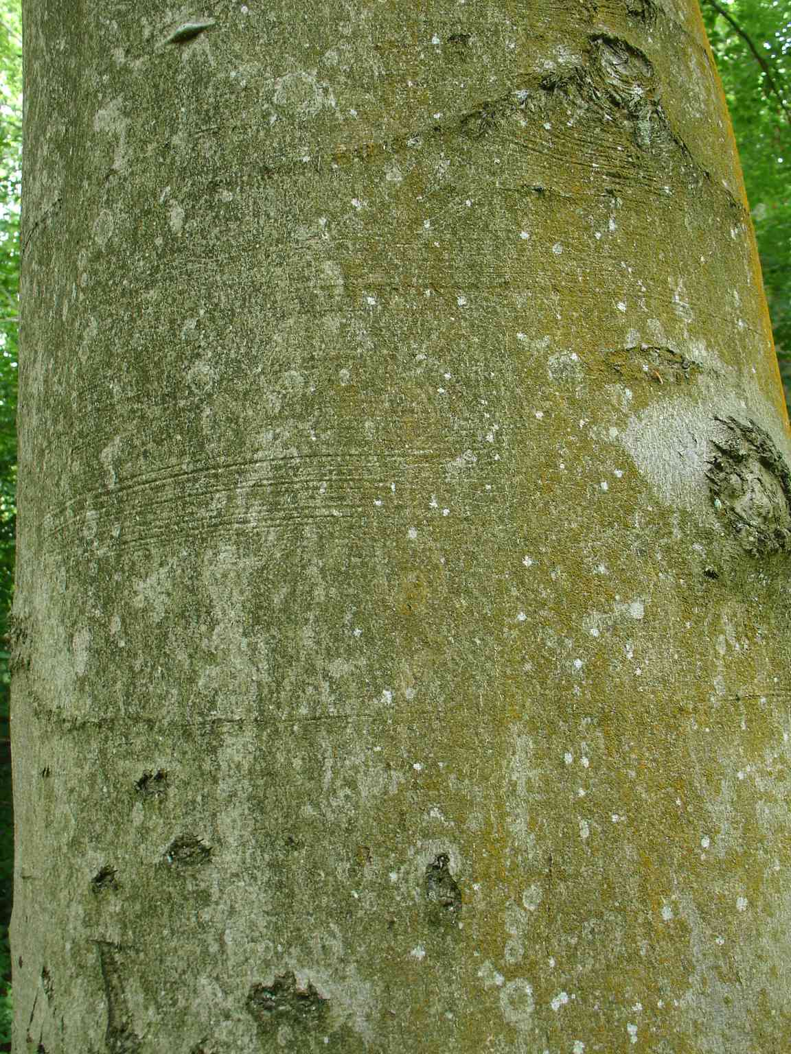
Post 1: Pause and look around at the trees and the undergrowth. Most of Old Redding Nature Reserve is covered by secondary woodland that has developed in the last 100 years in what was previously open grassland. The dominant trees are oak and beech, both of which are good at colonizing open ground. Even if you cannot see the leaves, it is easy to tell mature oak from beech (see images below). The bark of a mature oak tree is rough and fissured, like the hide of a crocodile, while unless they are injured the bark on mature beech trees remains flat and smooth. The smaller trees under the mature oaks and beeches are hazel and hawthorn ‐ both species that are able to grow in the dim light of a mature woodland.
Post 2: At this point almost every small tree has honeysuckle growing up it. We may think of honeysuckle as a garden plant, but it is a common woodland plant. In the dim light under the trees it rarely flowers.
Away from the path you can see many bracken fronds. Bracken, a type of fern, is a remarkably successful plant, able to grow both in woodland and in the open. It is thought to be the most common plant species in the world and is found on all continents except Antarctica!
Post 3: As you walked along the path to post 2 you were gently climbing. From post 2 to here the ground is roughly level, but from this point on you descend gently towards the north. You have passed the watershed; water falling on the car park runs south, towards Harrow, to be captured by the headwaters of the River Pinn. In contrast over most of Old Redding Nature Reserve streams flow north, to join the River Colne south of Watford. In fact the Colne eventually gets all the water from both sides of the ridge, because the Pinn flows west and joins the Colne just north of Uxbridge.
Look at the young trees growing at this point. Although above them are mature oaks and beeches, all the young trees are hornbeam. In summer you can recognise hornbeam by the finely toothed edges of the leaves ‐ like the tiny teeth you would see on a saw for cutting metal. Unlike oak and beech, hornbeam saplings can grow in the shade under mature woodland trees, so in time hornbeam will replace the oaks and beeches that dominate the woodland today.
As you walk on you will reach a pathmeet. Descend the steps and have a look at the information panel on the right then turn left along the side of the lake to find nature trail post 4.
Post 4: The pond beside the path occupies the eastern part of what was a single large artificial lake constructed between 1899 and 1905 for W (William) S Gilbert, who lived here from 1890 to his death in 1911. Gilbert is well known as the librettist (the person who writes the words) for the “Savoy” operettas created with the composer Arthur Sullivan. On 29th May 1911 Gilbert invited two local women to swim in the lake. He died attempting to help one of them when she got into difficulties.
In Gilbert’s day the lake was kept constantly topped up by pumping groundwater that then flowed into the lake down an artificial rocky waterfall. Without artificial aid the whole basin does not stay full, and by 2000 only two pools remained, the one you see here and another at the far western end. These were dredged in 2011 to increase their depth so that they would not dry out completely. In 2022 a third, central pond was created in a project funded by the Mayor of London’s ReWild London initiative which also carried out work to improve the whole area around the original lake.
If you have a dog with you please make sure that it does not enter any ponds on the reserve. Dogs cause very significant damage to freshwater ponds through three routes:
- Their feet damage the bottom and banks of the pond, preventing the growth of marginal plants and stirring up sediment that takes days to settle.
- The flea treatment in their fur kills freshwater invertebrates.
- Dogs pick up invasive bacteria, animals and plants in their coats and transfer them to other waterbodies.
In 2022 an invasive aquatic fern, Azolla filiculoides, was brought to the pond by an unknown animal and grew to form a thick mat over the whole surface, shading out all other plants. We are now controlling it using a biological agent (a small beetle) but this imposes an annual cost of several hundred pounds.
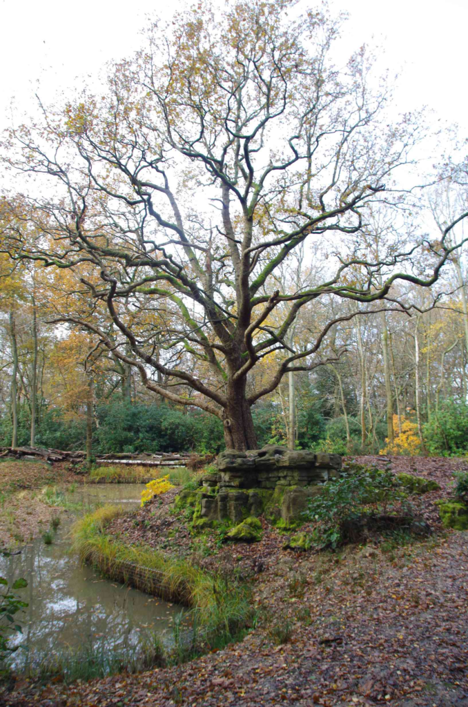
Continue around the old lake basin, ignoring paths that leave to the left, until you reach post 5. Soon after leaving post 4 you will see the remains of Gilbert’s artificial waterfall (see photo below). Later, after rounding the western end of the old lake, you will pass a rather ugly wire fence surrounding a telecommunications tower owned by British Telecom on land leased from Harrow Council.
Post 5: At this point we take a detour to see Grim’s Dyke and Lady Gilbert’s Orchard before returning to this point. Follow the upper arrow pointing to the left down an avenue at the end of which Grimsdyke House is just visible. You pass between two magnificent Wellingtonias Sequoiadendron giganteum. Redwoods like these were discovered in the 1850s during the Californian gold rush and are amongst the largest living things on earth. In spring primroses grow at the base of the trees.
At the end of the short path there is a wonderful view of Grimsdyke House, now a hotel which often hosts Gilbert and Sullivan themed concerts and events. Turn left and descend a short way, looking out for post 6 on the left of the path.
Post 6: Ahead the path cuts through an earth embankment. The embankment, and the water filled ditch just behind you, form Grim’s Dyke, a linear feature that can still be traced as far as Montesoles Recreation Ground in Pinner Green to the west, and which is probably the same structure that can be seen in Pear Wood in Stanmore to the east. It remains unclear when and why it was built although the best current guess is around 100 AD, as a boundary marker.
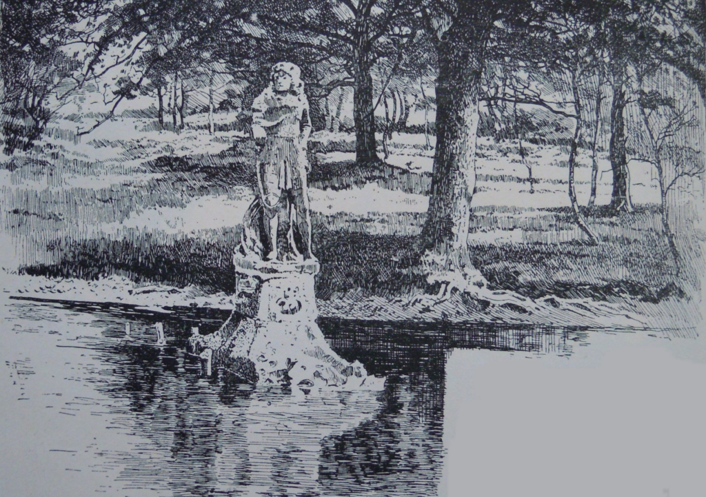
Grims Dyke has an unlikely connection with Soho Square in the centre of London. In 1681 a sculpture of King Charles II was installed in the square. In 1875 the statue was moved here and set up in the water filled ditch (see sketch below), only to be returned to the square in 1938, where it stands today as if it had never left.
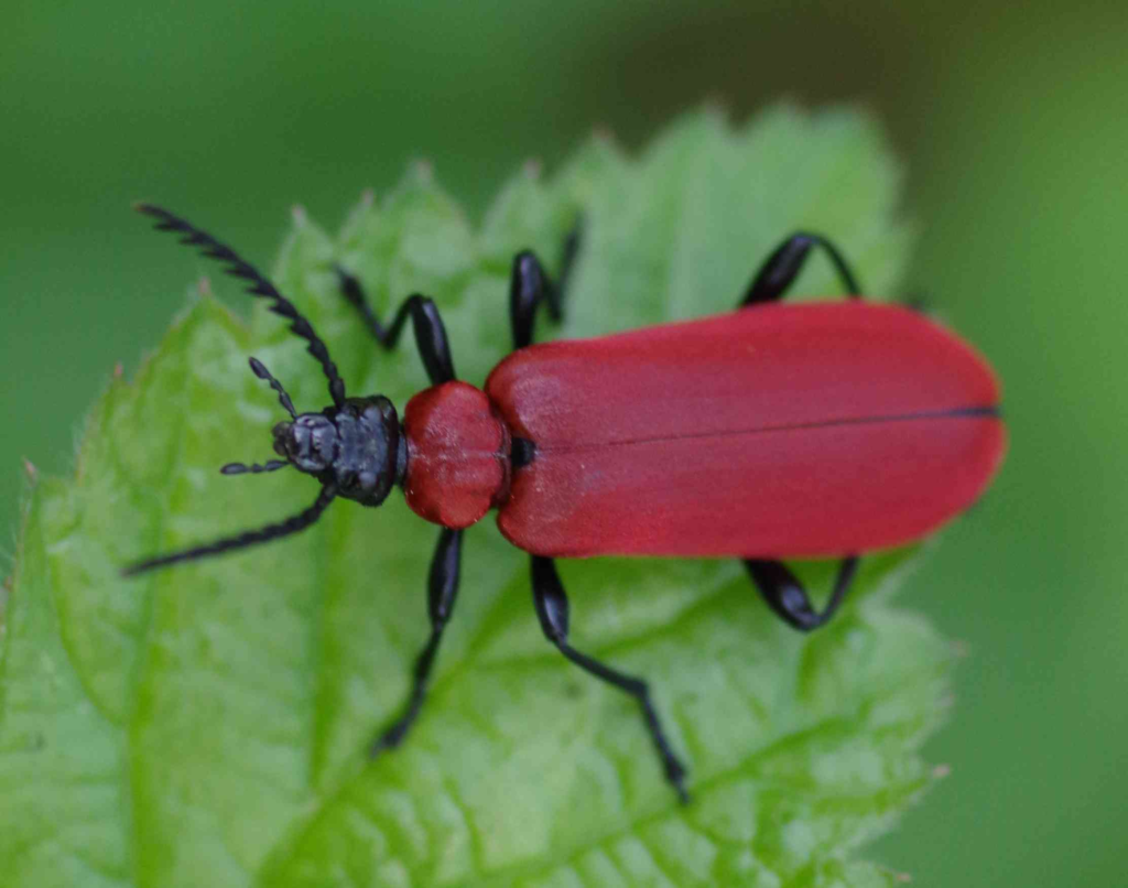
Continue downhill a little way until you reach Lady Gilbert’s Orchard, with its small information panel. This orchard was originally planted while the Gilberts lived here, and several old apple trees survive from that period, including a very rare variety called “Nelson’s Glory”. A number of interesting and uncommon insects live here including the Black Headed Cardinal Beetle Pyrochroa coccinea (image below). The wardens organize regular moth trapping and release in the orchard, and to date have recorded 176 different species!
Return to post 5 by the lake the way you came. At post 5, follow the lower arrow to continue round the lake back to the gravel steps. Go up the steps, but at the top take the left hand path at the fork.
Post 7: The earth berm to the left is much more recent than Grim’s Dyke and was created in Victorian times to mark the boundary of the formal gardens. This is why the woodland to the right is composed of native species, while to the left, in what was the formal garden, can be seen many attractive non native trees including redwoods and cedars.
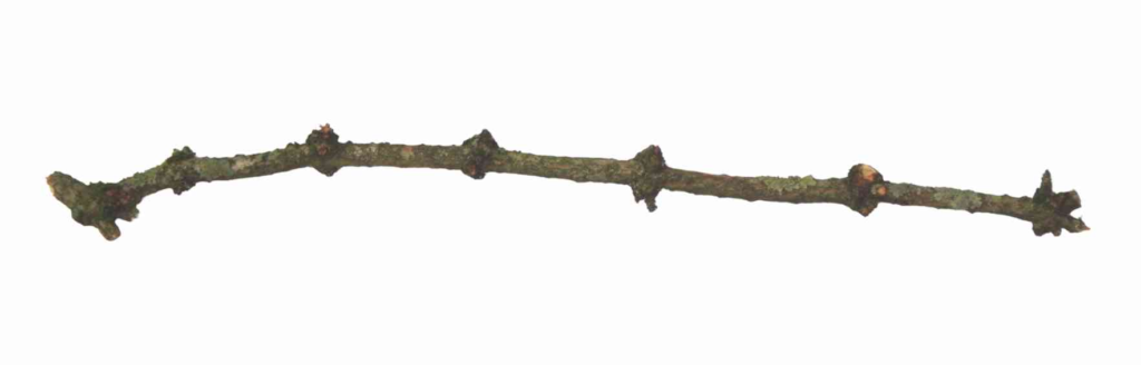
Post 8: The small tree on the right of the path immediately opposite to post number 8 is an elder. Elders can grow to be small trees, but often remain as smaller shrubs. The twigs have a characteristic appearance, with a series of knobbly knuckles, that is especially noticeable in winter. The shape was faithfully copied in the “elder wand” seen in the Harry Potter films (see image below). From this point you can follow the orange arrow straight ahead back to the road and your starting point.
If you would like to follow the next, longer section of the trail and explore the northeastern parts of the Reserve, then turn left as indicated by the purple arrow and follow the path up a short set of steps and into a tunnel of dense evergreen cherry laurel. Cherry laurel is native to regions bordering the Black Sea but is highly invasive in British woodland. Its dense evergreen foliage creates dense shade and prevents rain from reaching the earth, so that no plants are able to grow beneath it. Controlling cherry laurel is one of the main regular jobs of the teams managing Old Redding Nature Reserve. The shrubs are cut down and the stumps poisoned to prevent regrowth.
The route crosses the metalled access road to the hotel; keep ahead through the laurel to emerge into much more open woodland at a T junction. You have just crossed the boundary into the main space of Harrow Weald Common, which is common land. The land is now administered by Harrow Council, however as we will see the fact that it was common land has had a profound effect on the topology. Nature Trail post 17 is here, showing that we will return to this point later. For now turn left and walk gently downhill.
Post 9: The cottages here have a charming rural feel . Turn right in front of the cottages and follow the path with a drainage ditch immediately to the left. A little further on, the ditch deepens. The bank is topped with the remnants of an old hawthorn boundary hedge. Uncommon plants like wood sorrel and hard fern survive in the damp, shady conditions the ditch offers.
Post 10: Along this path all the way to post 13 the woodland to the right has been cleared of holly and cherry laurel. Although it is a native plant holly is a problem in woods in Harrow, outcompeting all other plants in the woodland understorey. Like laurel it is evergreen and shades both light and rain from the ground below, so nothing can grow below it. An ongoing component of management of the site is the cutting of holly and the poisoning of the stumps. Sometimes the poisoning is not completely effective, as evidenced by the many places where new growth has sprouted from the cut stumps.
Post 11: Just ahead is one of the many streams that drain this section of the reserve and run north to join the Colne. Just to the right of the path you can see a leaky dam, one of many that volunteers have created on the streams in the reserve. Leaky dams are good for wildlife, creating swampy areas with a distinct ecology to the drier woodland floor on either side. Many insect larvae need this sort of damp soil habitat. Leaky dams also perform a service for people: by holding up the flow of water during times of heavy rain, then releasing the water more slowly, they help prevent flooding in urban areas downstream.
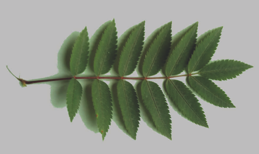
Post 12: Two small trees to the right of the path here are rowan, another tree that often forms the understorey underneath the larger oak, beech and hornbeam. In summer rowan is easily recognised by its pinnate leaves (that is, the leaves are divided into many smaller leaflets, see image below). Even in winter, rowan is recognisable by its purple buds with often profuse white hairs.
Just ahead a post marks where the London LOOP path leaves to the right accompanied by the Bentley Priory Circular Walk ‐ but we ignore this and continue ahead. Soon a series of three ponds appears to the left of the path . These were created in 2022 to improve the site for amphibians and other wildlife, in a project funded by Thames Water. Once again, as well as being good for nature, damming the streams provides a service for human residents downstream, preventing flooding at times of heavy rainfall. Aquatic and damp-loving plants have been planted around the margins of the new ponds, so please keep off to allow the plants to establish, and as noted earlier do not allow dogs into the water.
Post 13: Thick leaf litter covers the ground over most of Old Redding Nature Reserve, but spoil from the ditch that has been dug to direct water into the new pond is piled up on the right hand side of the path just behind you. Looking at this you see rounded pebbles in a sandy clay substrate: this is the layer known as the Claygate Beds, which sits on top of the London Clay and creates a very different, fast draining soil. Looking through the trees to the right you can see the busy A409 Common Road. The road is clearly higher than the ground level in the reserve. This is because in the 19th century enormous quantities of Claygate Beds material was removed from Harrow Weald Common, mainly for roadmaking. The mixture of gravel, sand and clay packs down into a good hard, fast draining surface that was used for roads before the advent of tarmac. Since the area was common land there was no legal authority to stop the extraction until parliament finally acted in 1899 and gave local authorities powers to regulate activities on common land.
Some way further on you reach the northern limit of Old Redding Nature Reserve and a set of steps up onto Common Road. Ignore the steps and instead turn sharp right to follow the boardwalk as it heads southwest.
Post 14: The steps on the left lead up to Common Road and carry the Bentley Priory Circular Walk. Across the road can be seen a half timbered house, Glenthorne Lodge. This was one of the old gatehouses to the Bentley Priory estate and the impressive iron gates to the left of the house remain from that time.
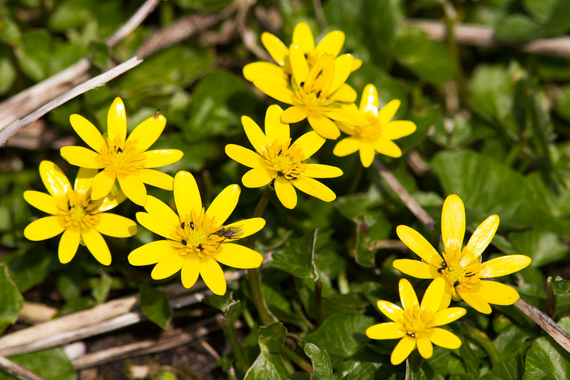
Our route continues straight ahead. If you are here in early spring (January through April) look out for the pretty yellow flowers of lesser celandine Ficaria verna on both sides of the path just beyond post 14 (see image below). This pretty member of the buttercup family appears very early in the year, before the woodland trees have put out their leaves. Once the trees come into leaf in April/May, there is very little light for the celandines to use and the plant abandons its leaves, transferring all the nutrients down into corms below the ground, ready to fuel rapid growth next spring.
Post 15: The area behind the fence on the left is private land and because of this was not subject to as much gravel extraction as experienced by Harrow Weald Common. As a place where the Claygate Beds have been less damaged, the area behind fence is a geological Site of Special Scientific Interest (or SSSI). As you look ahead the difference in height between the original ground level, along which the fence runs, and the present level in the Reserve is obvious.
As you walk ahead watch out for an arrow directing you to the left, beside an old bench.The area behind the fence on the left is private land and because of this was not subject to as much gravel extraction as experienced by Harrow Weald Common. As a place where the Claygate Beds have been less damaged, the area behind fence is a geological Site of Special Scientific Interest (or SSSI). As you look ahead the difference in height between the original ground level, along which the fence runs, and the present level in the Reserve is obvious.
As you walk ahead watch out for an arrow directing you to the left, beside an old bench.
Post 16: Some of the drainage ditches which cross the Common have their source within the SSSI. Around the channels, where there is enough light, uncommon plants occur e.g. the lesser spearwort with its attractive yellow flowers, another member of the buttercup family.
As you walk ahead the ground is increasingly hummocky and uneven, the result of hand digging for the Claygate Bed material. These gravel banks and hollows are now home to unusual plants including rare ferns.
You reach a sharp right turn, indicated by arrows, and descend a little way to reach post 17.
Post 17: Just by the post are cut logs left on the ground to rot. Wherever possible we leave fallen dead wood since it is an excellent habitat for fungi and insects. Turn left and retrace your steps through the cherry laurel jungle, crossing the metalled road to the hotel, to arrive back at nature trail post 8. Turn left to return to the road and your starting point – or to find post 1 if you have not yet done that bit of the trail.
We hope you enjoyed the trail. Please send comments and corrections to admin@harrowncf.org. If you have pictures we could share on social media, please send them too!