Stanmore Common is the open space in Harrow with the greatest sense of wildness. Visitors feel that they could get lost in the network of winding paths.
This sense of remoteness is valued by many visitors but discourages others. The paths can be muddy so except in the height of summer visitors should wear stout shoes or boots.
In contrast to the other open spaces in Harrow’s Green Belt, which look out over urban Harrow and central London towards the North Downs, views in Stanmore Common are northeast over open land albeit cut by the M1 motorway.
The soil grades from London Clay in the lowest, northeast sections through Claygate Beds to the quickly draining Stanmore Gravels on the north, west and south. Stanmore Common contains good examples of three habitat types and their associated fauna:
- Mature woodland On the south and west sides of the site the woodland suffered significant felling around the 2nd World War but is otherwise likely to have been continuously wooded since 1660. It contains a rich flora including many ancient woodland indicators together with a rich invertebrate fauna, many of which depend on the considerable amounts of standing dead timber. To the north of the site is a wood of oak, ash and Norway maple with an understorey of English elm. Sparrowhawk breed in this area.
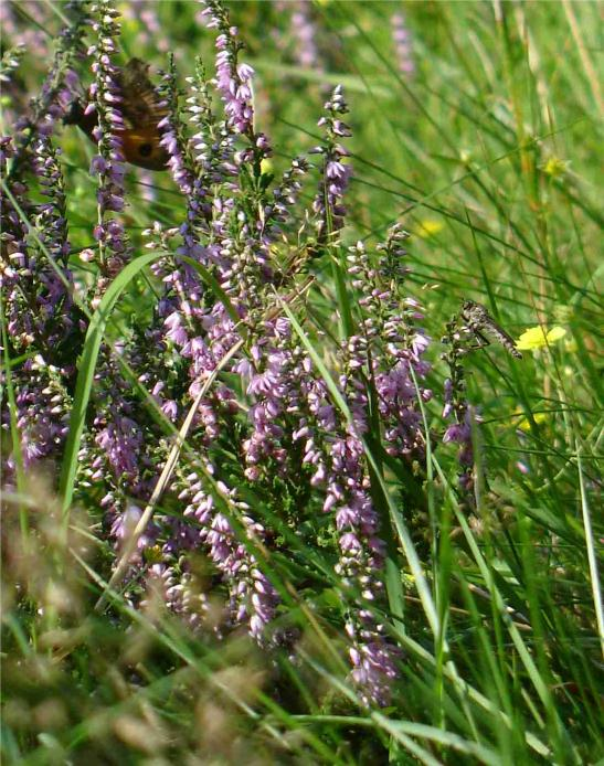
- Acid grassland and heath is a rare habitat in southeast England. The loss of large areas of open heath on Stanmore Common was recorded by the local naturalist Eliza Brightwen, who described in 1904 how the “golden sheen of the furze blossoms spreading over more than two hundred acres” she remembered from 1880 had been replaced by birch woodland. By 1990 only a few small glades retained the lovely, special flora including heather, white heath bedstraw and yellow-flowered tormentil. Considerable work by volunteers rescued heather bushes from under the deep shade of willow scrub and restored the open glades of Cerrislande and Oakmead to complex and lovely mosaics of grasses, both tall and short, mixed with young tree saplings, heather, bracken, and gorse. These are lovely places to come upon when the low winter sun illuminates frosty grasses, or to rest among flowers on a warm summer’s day. A project funded by the Heritage Lottery Fund in 2012-2015 performed a similar but larger scale restoration of Bluebell Heath. Bands of scrub were be cleared, and a small section of young birch woodland was be cleared and reseeded with heather. Bluebell Heath now provides considerable space for colonization by the flora and fauna of the smaller residual acid grassland habitats, helping to ensure the survival of these plant and invertebrate communities including the relatively uncommon Brown Argus butterfly.
- Wetlands develop in springs and flushes on the interface between the Stanmore Gravel/Claygate Beds and the London Clay and are home to a specialized community of plants and invertebrates including rarities such as Sphagnum moss. All the streams on the common drain into the marshy Pynding Mersc, an excellent woodland wetland.
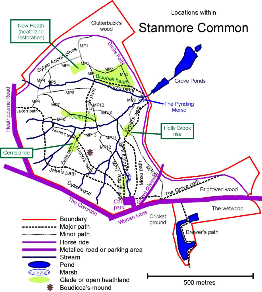
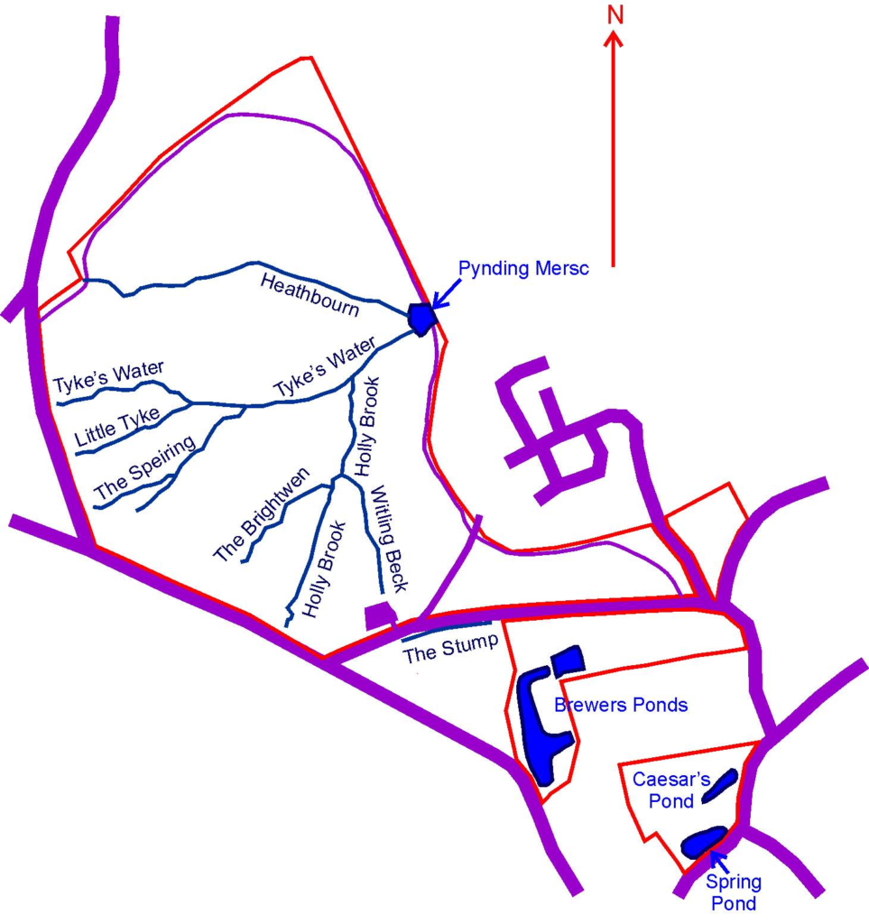
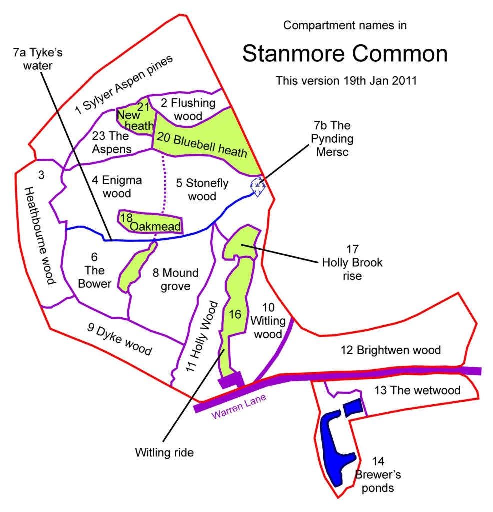
There is a long history of human settlement and activity in Stanmore and clues of this are present all over the Common. The open heaths themselves are the result of clearance in the 17th century, while a series of earthworks probably all belonged to a 16th century or later rabbit warren documented in 1667 as the coney warren. The rounded hill-like mound called Fox-Earth is the most obvious, but this may possibly be an older mound re-used. South of Warren Lane lie Brewer’s Ponds, created in the late 19th century as a reservoir to serve Clutterbuck’s Brewery.
A Nature Trail with two alternative routes, one 1.2 miles long and one just under one mile long, begins at the Warren Lane car park and shows visitors many aspects of the site. Leaflets are usually available in a metal dispenser at the car park. Alternatively use one of these sources:
- Version suitable for smartphones can be accessed here for the long walk and here for the short walk – or by QR tags on the posts as you walk the trail. This is the most complete version of the guide.
- Text version suitable for printing and taking along with you, but without maps or illustrations.
- Full PDF copy of leaflet, with maps and illustrations – but note this is intended to be printed on A3 paper; if printed on A4 text size will be very small.
- Link to PDF with more details about Stanmore Common
How to Find The Reserve
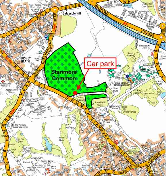
The number 142 bus runs along the A4140 “The Common” while the junction of the A4140 “The Common” and the A409 Common Road is served by the 258 bus. There is a car park off Warren Lane (post code HA7 3HJ, map reference TQ 1600 9353).
Alternatively a pleasant and largely road-free route leads from Stanmore Common through Stanmore Country Park to Stanmore Jubilee Line station – click here for details. The meeting place for all events such as guided walks and conservation work parties is the car park in Warren Lane.
The Common is managed by voluntary wardens who work to record species and enhance the site’s biodiversity. Larger scale work, such as mechanical cutting of the open areas to prevent scrub growth, is performed by council contractors. Stanmore Common needs volunteers. If you would like to help, whether at one of our working parties or as part of the warden team, contact us as below.
Latest Events

Restoration of Bluebell Heath in the North of the site was supported by the Heritage Lottery Fund.
Contact Details
Stanmore Common has an active warden team